Real Estate · Columbus, Ohio
Real estate drone photography in Columbus
Show the property, setting, access, acreage, and nearby features in a single compelling view. Drone Shots Columbus creates polished aerial photos and video for homes, land, churches, commercial properties, and distinctive Central Ohio listings.
Discuss Your Project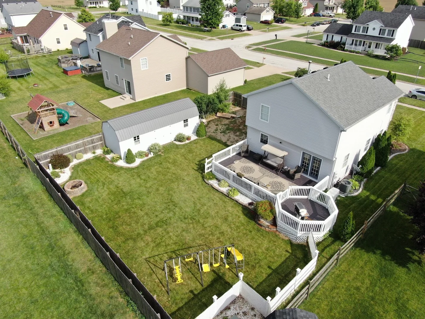
A stronger first impression for your listing
Ground-level photos explain the rooms. Aerial photography explains the property. It can show lot lines in context, landscaping, outbuildings, water features, access roads, nearby amenities, and the relationship between the home and its surroundings.
That wider perspective is especially useful for acreage, luxury homes, commercial properties, new construction, churches, farms, and any listing where location or scale is part of the value.
What your aerial package can include
The basic package includes up to 30 minutes on location and 10 professionally edited aerial photos for $200. The standard package includes up to 60 minutes, 20 edited photos, and a one-to-two-minute aerial video for $400. Rush delivery may be available for an additional $50.
Before the flight, Chris reviews the location, airspace, weather, timing, and the features you most want to highlight. The result is a focused shot plan rather than a collection of generic overhead images.
Local service throughout Central Ohio
Real estate drone photography is available in Columbus, Groveport, Canal Winchester, Pickerington, Reynoldsburg, and surrounding Central Ohio communities. Every project is subject to safe weather, legal airspace access, and site-specific flight conditions.
Common Questions
What to know before you book
How much does real estate drone photography cost in Columbus?
Packages start at $200 for up to 30 minutes on location and 10 professionally edited aerial photos. A $400 package adds more photos and an edited aerial video.
How quickly will I receive the photos?
Delivery timing is confirmed before the flight and depends on the project scope. Rush delivery may be available for an additional $50.
Can you fly at every property?
Not always. Weather, airspace restrictions, nearby airports, people on site, and property conditions can affect feasibility. Each location is reviewed before scheduling.
Ready to Plan the Flight?
Let’s create the right aerial view.
Share the location, timing, and what you need to capture. Chris will review the details and follow up with the best plan.
Request a Quote